Science in Action
Adaptive Management relies on the concept of “learning by doing”. Private forest landowners are doing just that by participating in a wide breadth of studies across the forest landscape to evaluate and identify best, most sustainable forests practices.
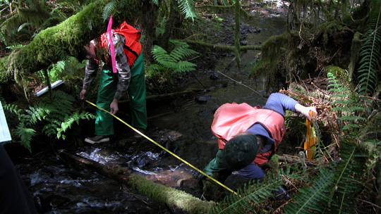
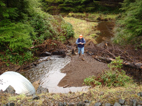
Measuring wetted channel width to characterize stream in a non-fish-bearing streams study.
Adaptive Management:
Letting Science Lead the Way
Science in Action
Research Organized by Rule Groups
Research programs and projects are developed across the working forest landscape to address critical research questions. Studies are designed in one of 10 identified "rule groups" or zones on working forestlands. The ten rule groups include: 1.) Stream Typing, 2.) Fish Stream Riparian Zone (Type F), 3.) Non-Fish Stream Riparian Zone (Type N), 4.) Channel Migration Zone, 5.) Unstable Slopes, 6.) Roads, 7.) Fish Passage, 8.) Pesticides, 9.) Wetland Protection, 10.) Wildlife Protection.
Stream Typing
Develop a statewide stream type map to identify fish habitat streams used by fish at any life stage at any time of the year.
Fish Stream Riparian Zone
Provide key riparian functions for including bank stability, shade, wood recruitment, litter fall and preventing sediment delivery to streams.
Non-Fish Stream Riparian Zone
To protect amphibians and ensure stream temperature is cool in water leading in to fish bearing streams.
Channel Migration Zone
Examine use of streamside buffers to benefit wildlife habitat.
Unstable Slopes
Avoid timber harvest activities on potentially unstable slopes to protect water quality and aquatic habitat.
Roads
Protect water quality by disconnecting road drainage systems from the stream network, to avoid sediment delivery to streams.
Fish Passage
Remove barriers to restore passage for fish in all life stages and provide for passage of some woody debris.
Pesticides
Maintain clean water by preventing forest herbicides from entering streams.
Wetland Protection
Achieve no net loss of wetland function by providing wetland buffers.
Wildlife Effects
Maintain healthy riparian habitat for aquatic species.
Key Questions Adaptive Management Science Addresses: • Are forest practices in compliance with prescriptions? • Are prescriptions effective in achieving performance targets? • Are assumptions underlying targets valid?
Research and Monitoring—A Comprehensive Approach
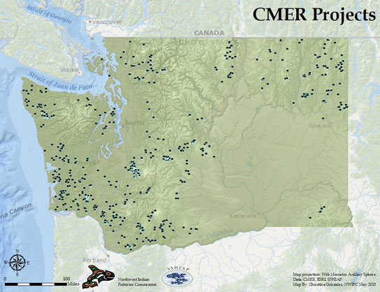
Cooperative Monitoring Evaluation and Research Committee (CMER) provides the science needed to support adaptive management. The CMER Work Plan consists of 101 projects ongoing since 2001. Approximately 44 are complete, and 22 are ongoing. Five new projects are scheduled to start in the 2019-2021 budget cycle.
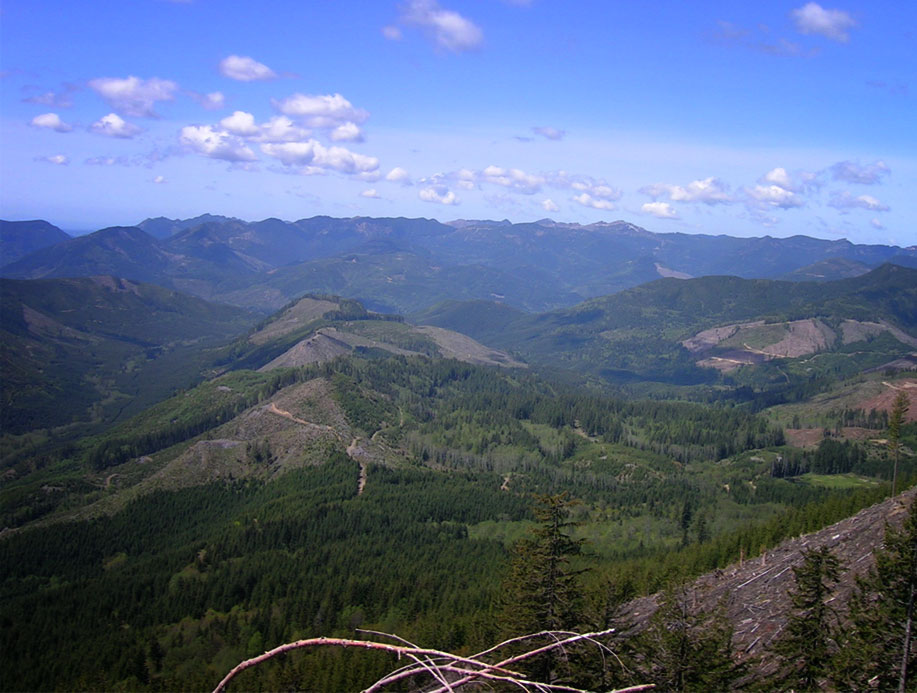
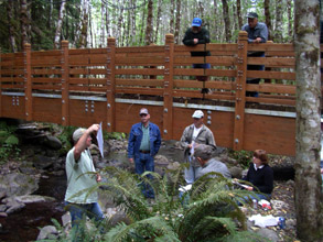
Field work for adaptive management science continues across Washington’s state and private forests. Replicating studies in different locations strengthens confidence in the results.
Rule Implementation Tools On the Ground Implementation
| Methodological: development, testing or refinement of field protocols and models used to identify important landscape features, e.g. water type breaks, unstable slopes, and sensitive sites. |
| Target Verification: verify assumptions and targets thought to have an uncertain scientific foundation. |
Developing, testing or refinement and validating protocols, models and targets used to implement the forest practices rules on the ground.
Effectiveness Monitoring Site-Level
Effectiveness Monitoring evaluates the performance of forest practices at the site scale. Also known as "prescription" or "best management practice" (BMP) monitoring because they are conducted at a site-scale.
Evaluating the degree to which Washington Forest Practices Rules and guidance meet performance targets and resource objectives at the site-level.
Cumulative Effects and Validation Monitoring Watershed-Level
Intensive Monitoring: evaluates the cumulative effects of multiple forest practices at the watershed scale. Understanding the effects of individual actions on a site and the interaction of those responses through the watershed, gives information to validate and determine if the performance targets are appropriate for meeting the resource objectives.
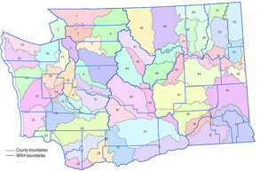
A "watershed" is an area draining into a river, lake or other water body. The state is divided into 62 'Water Resource Inventory Areas" or "WRIAs" to delineate the state's major watersheds.
Extensive Status & Trends Monitoring Statewide Landscape-Level
Extensive Monitoring: tracks key watershed processes and habitat conditions across the landscape. It takes a look, statewide, at the effects of forest practices on the landscape and determines whether progress is consistent with expectations across the 9.3 million acres of forestland covered in the FPHCP.
Over half of the state is forested, 22 million acres. Federal lands account for more than 40% of the land base, with nearly 10 million acres. Private, State and County lands add up to about 10 million acres, the rest is tribal lands.