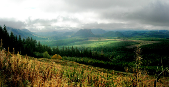
Private Forest Landowners are Making a Difference
by Providing Steep Slope ProtectionLandslides are a natural geologic process in the steep forestlands of Western Washington. They can play an important role in delivering wood and gravel to streams, to create high quality stream habitat for fish. With the Forests & Fish Law,foresters have taken important steps to include protection of potentially unstable slopes in their timber harvest designs, to prevent timber harvest and road construction activities from increasing the natural rate of landslides.


Limiting the rate of landslides with technology and science
Using modern scientific methods, private forest landowners have developed ways to identify areas of greatest risk and avoid timber harvest in these areas. Landslides are detrimental to private forest landowners, resulting in lost trees and damage to property. Forest landowners have a vested interest in preventing landslides. When a private forest landowner applies for a permit to harvest trees or build roads, a rigorous screening process is conducted before the permit is granted. The rules specifically address the issue of landslide control—with a goal of not increasing the natural background rate of landslides as a result of forest practices.
Project level design and engineering review to avoid landslides
Private forest landowners and the Department of Natural Resources work with highly skilled geologists who utilize a suite of tools to determine landslide-prone areas prior to receiving a Forest Practice Application. These tools include in-field surveys, mapping, air photos, Landslide Hazard Zonation, risk modeling and other technologies. Where mapping technology show high risk, a field investigation is conducted and a geotechnical report is prepared by state licensed geologists who report their findings to the landowner and the Department of Natural Resources.
Rule-Identified Land Forms
Forest landowners avoid increasing the natural rate of landslides during forestry harvest operations by avoiding potentially unstable slopes across the landscape, identified by the State’s rules on landform characteristics. When an area is deemed unstable, the default action on the part of the forest landowners is to avoid the area. This differs from other land uses—such as urban development—where zoning rules seek to mitigate (not avoid) landslide risk by stabilizing steep slopes through drainage, retaining walls and bulkheads. Learn more.
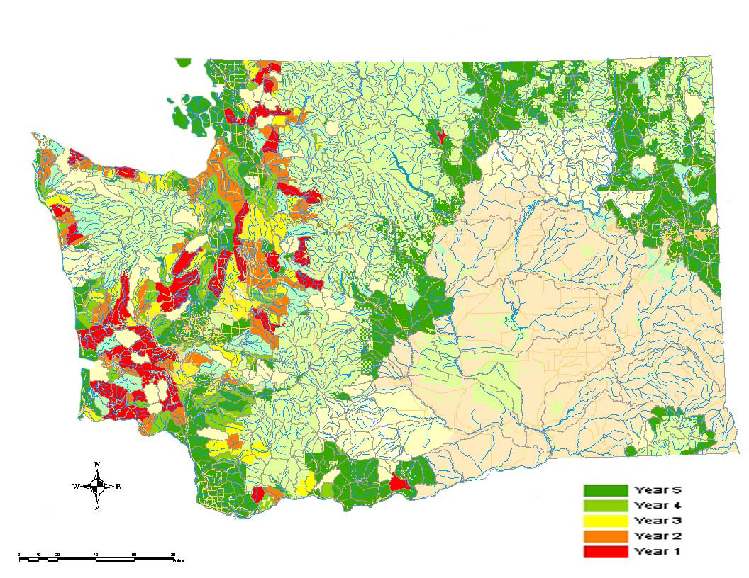
Landslide Hazard Zonation Projected Work Priority Map
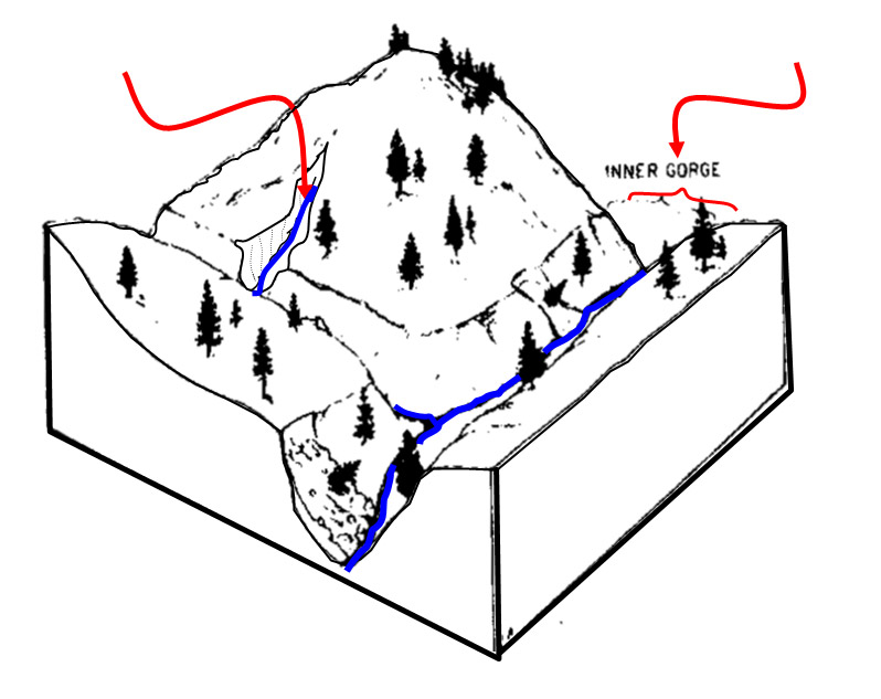
Rule Identified Land Forms: Inner Gorge
Limiting the rate of landslides through science-based learning
As with all forest practices, forest landowners look to the latest science to guide their actions in attempting to limit the rate of landslides. Several studies have been conducted on this topic and the industry will guide future changes to forest practices based on the outcomes of the research.
The Forest Service Pacific Northwest Research Station recently compiled over 30 years of research into a study, and found that the impact effects of forest harvest on flooding in the Pacific Northwest is relatively minor in comparison to other man-made changes to streams and watersheds. The impact of forest harvest in the Pacific Northwest on flooding is substantially less than that of dams, urbanization, and other direct modification of channels. Experts have found connections between flooding and landslides. Given the fact forest practices have minor effects on flooding, the same practices are helping to prevent landslides.
Currently the Department of Natural Resources’ CMER (Cooperative Monitoring, Evaluation and Research Committee) is studying the effectiveness of Forest Practices Rules at limiting landslides from forest practices by analyzing storm-related landslides.
Guided by science: Peer-reviewed research
An unusually powerful storm in early December of 2007 caused record flooding and thousands of landslides across southwest Washington and northwest Oregon, provided a rare opportunity to examine the effects of both natural factors and forest management practices on landslide density. Recently peer-reviewed research conducted by the Weyerhaeuser Company is expected to complement the CMER study that is now nearing completion. It provides information on the relationship between landslide rates and intensities to precipitation, age and topography. The results of this scientific process will be to make recommendations to the policy makers for final consideration before the Forest Practices Board.
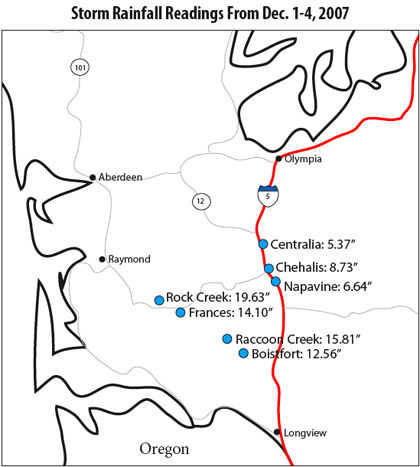
Storm Rainfall Readings from December 1-4, 2007